LISTEN TO THE PLACE
A story worth knowing
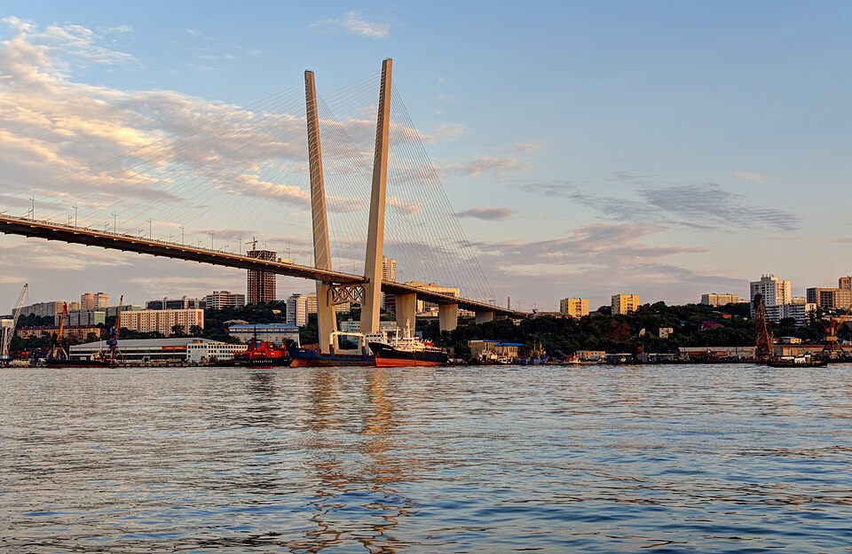
The Golden Bridge looks like a grand gesture across the city: two tall supports and fans of slender lines above the bay. First, though, imagine Vladivostok without it. The opposite shore appears close, yet reaching it by road requires going around the water. In a city of hills and long inlets, distance on a map has never told the whole story.
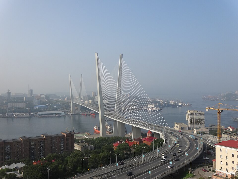
The bridge across Zolotoy Rog, or Golden Horn Bay, opened in August 2012 as Vladivostok prepared to host the APEC summit. Construction had begun in 2008. The crossing linked the central city with the Cape Churkin district. For visitors, it is a striking silhouette; for everyday journeys, it changed the network of connections. Transport engineering sometimes produces a city's most recognisable landmark.
Look at the supports, which resemble the letter V. Cables run from them to the road deck. Follow one visually from its upper attachment towards the roadway. What seems almost like a line drawn across the sky is part of the system carrying the load. The apparent lightness of a cable-stayed bridge depends on substantial structural work.
The bay continues to operate beneath the crossing. Space was needed for vessels below as well as vehicles above. Two transport systems meet at different levels. Include the shore and water in your view, and the problem becomes clear: this is not merely a long road but a structure fitted into a working port city.
There is an essential detail for our walk: pedestrians are not permitted on the Golden Bridge. This stop concerns a view from the shore or an accessible city viewpoint. Do not try to reach the traffic deck. From outside the crossing, you can better understand the height of the supports, the pattern of cables and the relationship between the two banks.
The Golden Bridge is also distinct from the Russky Bridge. One crosses Golden Horn Bay within the urban area; the other crosses a strait to Russky Island. Photographs can merge them into a single first impression, but they perform different tasks and reveal different scales of Vladivostok.
Keep the hills in the picture. They explain why the bridge appears from so many unexpected angles. Your height above the water changes repeatedly while exploring the city, yet the crossing remains a reference line to which your eyes can return. It helps turn a complicated arrangement of slopes and shores into a recognisable urban landscape.
Learn more
A bridge can be read as a diagram of forces. The road deck carries vehicles; the cables transfer part of the load to the tall supports, which transfer it towards the foundations. We cannot see every structural detail, but the main relationships are displayed outside. That makes this an inviting piece of engineering to examine.
Compare an oblique view with one looking more nearly along the deck, where safe public viewpoints allow. From one angle, the cables separate into a clear fan. From another, they overlap. The image changes while the structural task remains the same.
Try taking two different photographs. Include the bay and shores in the first to show the problem the bridge solves. Isolate a support and its cables in the second to show part of the solution. Both views can be explored from pedestrian areas without entering the road crossing itself.