LISTEN TO THE PLACE
A story worth knowing
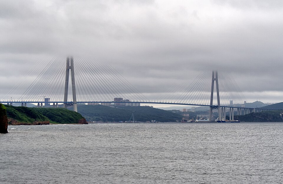
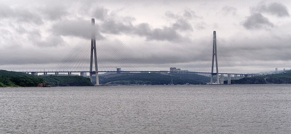
In photographs, Russky Bridge can look almost weightless: two tall towers, a slender roadway and a fan of cables. Seeing it across the Eastern Bosphorus Strait changes that impression. Russky Island lies beyond the water, and the bridge makes the city's geography tangible. Two shores may seem close on a map while still requiring a formidable engineering effort to connect them.
Construction began in 2008, and the bridge opened in 2012, when Vladivostok hosted the APEC summit. It linked the mainland part of the city with the island. This was one of two celebrated cable-stayed bridges completed in Vladivostok at that time. To distinguish them, remember that the Golden Bridge crosses Golden Horn Bay, while Russky Bridge crosses the strait towards the island.
Look at the central section between the towers. Its span measures 1,104 metres. That figure describes the main span, rather than the entire route with its approaches. Bridge descriptions can contain several different lengths without contradicting one another: they may simply measure different parts of the structure.
The towers rise to 324 metres. Cables run from them down to the deck, supporting the roadway and transferring loads towards the towers. What appears to the eye as a delicate pattern is also a visible part of the bridge's structural system.
The long open span leaves room for shipping. Its dramatic silhouette therefore answers a practical requirement: connecting the shores by road while keeping the maritime route open. Two flows of traffic intersect here at different levels, with vehicles crossing the strait and vessels passing along it.
For a walking visitor, the bridge is a subject to observe from shore, rather than a pedestrian crossing. Do not continue a walking route onto its road deck. A suitable viewpoint lets you see the composition as a whole, including the island's slopes and the water beneath. Mist can alter the apparent distances and make the familiar outline look quite different.
You may have seen it before arriving: Russky Bridge appears on Russia's two-thousand-ruble banknote. The small image cannot convey the breadth of the water. For a moment, set aside the camera and follow the route with your eyes from shore to shore. That is the distance the engineers had to turn into an everyday road connection.
Learn more
Russia's two-thousand-ruble banknote shows Russky Bridge on one side and the Vostochny Cosmodrome on the other. Both represent the Russian Far East, but they are not neighbouring attractions. The spaceport is in the Amur Region, far from Vladivostok.
A banknote provides an interesting comparison between a symbol and a place. Its designer must choose a few instantly recognisable features. For this bridge, the towers and cable pattern do much of the work. The surrounding landscape becomes secondary so that the image remains clear at a small scale.
On the shore, the relationship changes. Water, wind, distance and island slopes restore the structure's context. Imagine making your own miniature emblem: which two or three lines would you retain? Then look at the complete landscape again. The comparison reveals how much disappears when a real place becomes a city's visual symbol.