LISTEN TO THE PLACE
A story worth knowing
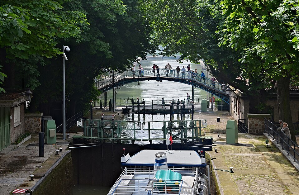
The Canal Saint-Martin reveals Paris at a different scale from the broad Seine. Water lies closer to the pavement, bridges feel more intimate, and locks make movement visible and slow. Our stopping point is near Pont Bernadette-Lafont, by Rue Dieu, but the story concerns the canal as a wider urban system.
The canal opened in 1825. It belongs to the history of supply and transport, rather than having been created as a romantic setting for cafés. Water routes helped serve the growing city, move goods and connect parts of its infrastructure. The banks were working places where usefulness mattered more than a picturesque view.
Locks allow boats to pass between different water levels. If you see a vessel moving through one, watch the changing water as well as the gates. The boat is not lifted by a separate crane. Its position changes with the level inside the chamber. A few minutes of observation can turn an ordinary walk into a clear introduction to an engineering principle.
Part of the canal runs beneath the city, so the visible stretch does not reveal its full extent. Streets can continue above infrastructure that a pedestrian barely notices. This is a useful reminder that the surface map and the working structure of a city are not identical.
The surrounding neighbourhood has changed over time. A former working environment became an attractive place for strolling, meeting and relaxing. Footbridges, reflected trees and slow-moving water helped create an image of a less formal Paris. Under that contemporary atmosphere, the technical logic remains: levels, gates, controlled passage and continual maintenance.
Walk a short section along a permitted bank and compare the views before and after a bridge. There is no need to locate one perfect photograph. Repetition and small differences are part of the canal’s character. A change of position can alter the relationship between water, trees, boats and buildings without requiring a long journey.
Respect barriers and current closures; individual crossings may be under repair. Some bridge names have also changed, so follow up-to-date signs rather than relying entirely on an older map or remembered name.
This stop shows how infrastructure can acquire a second cultural life. A route built for practical movement becomes somewhere people deliberately visit in order to slow down. The canal has not lost its engineered nature; instead, that nature has become part of its attraction. Watching water being managed can be as revealing as admiring a monumental façade elsewhere in Paris.
Learn more
The canal has several bridges and locks, so a photograph of one section may not show the spot where you are standing. Our point is near Pont Bernadette-Lafont, formerly identified with Rue Dieu. It helps to distinguish a specific stopping place from the entire linear landmark. If you continue along the water, use currently available pedestrian crossings rather than assuming that you can change banks wherever you wish.